Aerial Mapping
EVC Drone Solutions provides aerial photogrammetry services that create digitized, high-resolution 2D and 3D models.
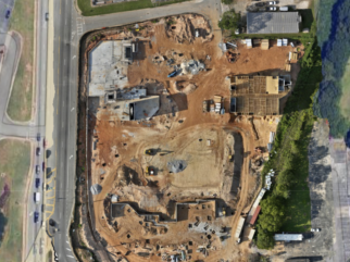
These models are ideal for tracking construction progress, inventorying stockpiles, assisting with asset management, and more.
Enhance your project management and operational efficiency with EVC Drone Solutions' advanced aerial photogrammetry technology.
Uses & Benefits
Time-Efficient Mapping
EVC Drone Solutions offers time-efficient mapping services.
Unlike traditional ground-based methods, our drones capture all necessary data quickly, providing deliverables with a faster turnaround time.
Improve your project timelines and efficiency with EVC Drone Solutions' advanced drone mapping technology.
Mapping Data & Quality
EVC Drone Solutions utilizes advanced drone cameras to capture millions of data points, elevation points, and colors.
This data allows us to create high-resolution orthomosaics and 3D models of sites or buildings, offering clients a level of detail far beyond traditional surveys.
Experience superior mapping quality with EVC Drone Solutions' cutting-edge drone technology.
Cost-Effective Solutions
EVC Drone Solutions helps you save on equipment and labor costs while providing high-quality images and data for critical decision-making and remote job site monitoring.
Optimize your budget and operations with EVC Drone Solutions' efficient and affordable drone services.
Stockpile Measurements
EVC Drone Solutions offers precise stockpile measurement services.
Utilizing commercial drones, high-quality cameras, and robust processing applications, we deliver comprehensive stockpile measurement reports with volumetric data to accurately track inventory.
Streamline your inventory management with EVC Drone Solutions' advanced aerial solutions.
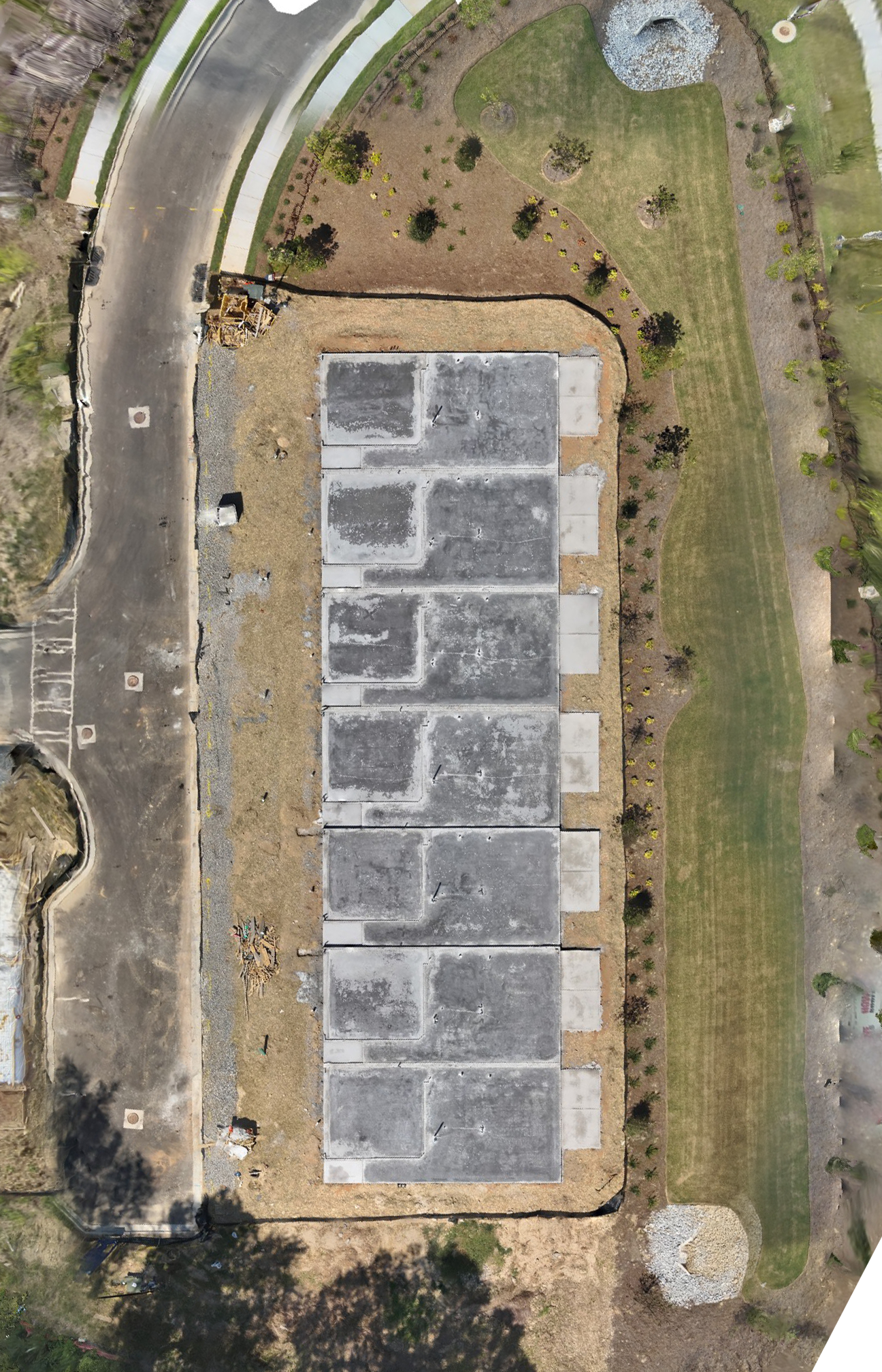
Before Image:
This image showcases the townhouse construction site at its foundational stage, with the concrete slabs freshly laid. The clean, organized layout of the slabs provides a clear view of the project's groundwork, offering insight into the early stages of development.
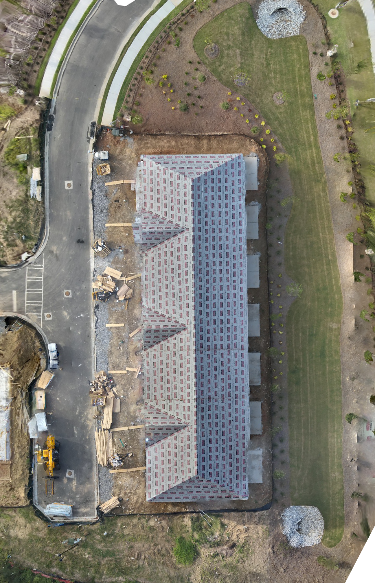
After Image:
The after image captures the next phase of construction, with the frames of the townhouses fully erected. The structural framework, including walls and roof outlines, is prominently visible, illustrating the transition from foundation to structure.
Summary:
This before-and-after comparison highlights the significant progress in townhouse construction, transitioning from the foundational concrete slabs to fully framed structures. Ideal for tracking development milestones, this comparison underscores efficient construction practices.
Contact Us

EVC Drone Solutions
Copyright © 2024 EVC Drone Solutions, LLC . All Rights Reserved.

